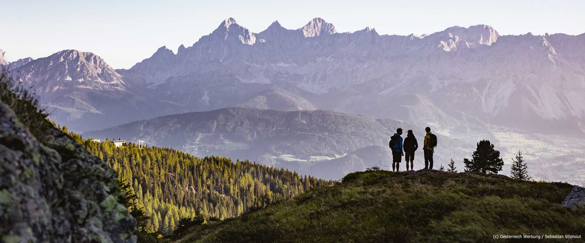
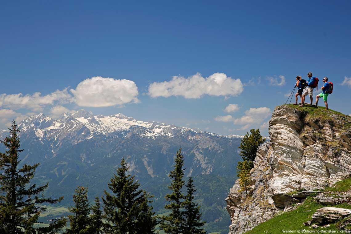
Walking along the summits and ridge lines of the Schladminger-Tauern mountains
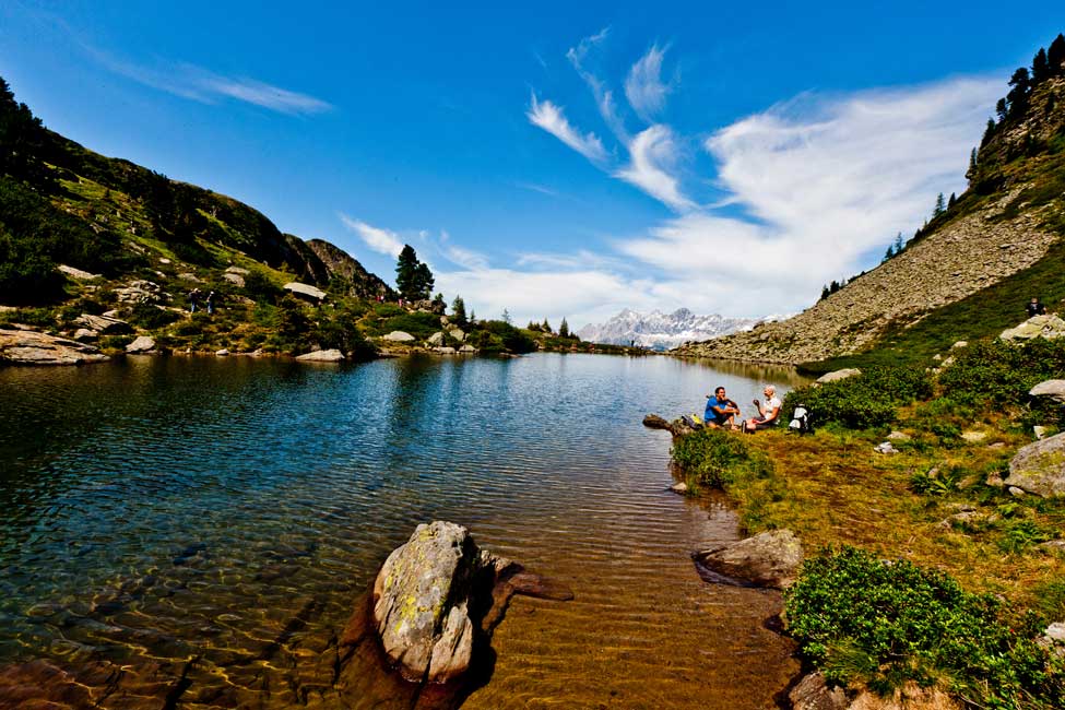
Idyllic valleys, alpine lakes, mountain streams and cascading waterfalls
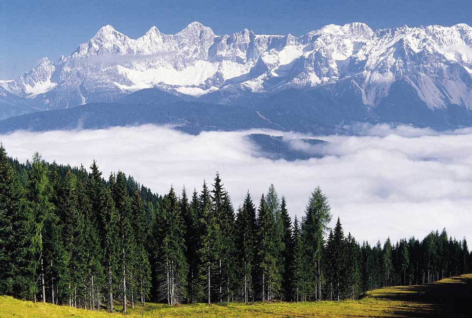
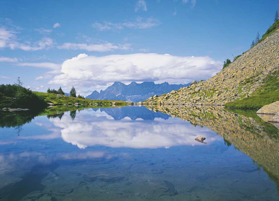
Panoramic views of the Dachstein massif
Unique geological features like the Klafferkessel tarns and Goldlacken plateaus
Stay in charming mountain huts and enjoy hearty Austrian cuisine
The Schladminger-Tauern Höhenweg trail is a stage along Central Alpine Trail 02, which traverses the entire Alpine region. This epic hike follows a dramatic high trail along the summits and ridges of the Schladminger-Tauern mountains (a subrange of the Austrian Central Alps), as well as dropping into idyllic alpine valleys and cirques.
Due to its unique geological features, the wealth of plant and animal species, and the special character of the surrounding mountains, this section of the Central Alpine Trail is one of the most beautiful hiking tours to be found anywhere in the Alps. Pristine, untamed streams with thunderous waterfalls and countless small rivulets flowing from springs beneath the Tauern mountains add to the appeal and charm of this region. Some truly impressive peaks, such as the Hochgolling, the highest mountain in the range (2,862 m), await you on this rewarding walking trail.
Please note that, due to the terrain and lack of road access luggage transportation is not possible on this trip.
| 7 DAYS / 6 NIGHTS | From €560 per person sharing*
*A high season supplement of €30 pp. will apply from 21/7 to 27/8. |
||||||||||||||||
| ACCOMMODATION | On the first and last nights you will stay in a *** hotel in Schladming/Rohrmoos-Untertal.
During the trek, you’ll stay in Alpine lodges (charming mountain huts) in either a lager (dormitory-style room), or private room. Notes on staying at an Alpine lodge:
|
||||||||||||||||
| MEALS | An Alpine breakfast buffet is provided each morning and is included in the price.
Most accommodations are happy to provide a packed lunch. This should be requested on arrival. Each hut serves hearty Austrian cuisine for dinner. You can either pay in cash at the lodges or you can pre-book a half board supplement to include dinner on each night (cost €230 pp. for dinner x 6 nights). Please let us know in the comments box on the booking page if you would like to do this. |
||||||||||||||||
| AVAILABILITY | You can start your trip on any day of the week (subject to availability) from July to September. | ||||||||||||||||
| INCLUDED |
|
||||||||||||||||
| NOT INCLUDED |
|
||||||||||||||||
| OPTIONAL EXTRAS |
|
||||||||||||||||
| DIFFICULTY & TERRAIN | The tour mainly covers alpine terrain. You will need appropriate mountain equipment and basic stamina. Necessary mountain equipment: ankle-high boots, functional clothes, rucksack, food and water, rain and sun protection, first-aid kit, mobile phone.
The routes are well signposted, although the signs could partly be covered by snow. Hence, it is imperative that you take your maps and route notes with you. An experienced guide is available to accompany you upon request. |
||||||||||||||||
Day 1: Arrival in Schladming-Rohrmoos
Individual arrival at your accommodation at Schladming-Rohrmoos. At check-in you receive your travel documents.
The former mining settlement Schladming is now a very popular destination for active holidays. The location of the town between the south walls of the Dachstein and the Schladminger Tauern, is simply magnificent.
Overnight stay in a ***Hotel in Schladming or Rohrmoos-Untertal.
Day 2: Hochwurzen High Trail to the Giglachseen Lakes
Distance: 10 km | Ascent: 783 m | Descent: 615 m | Walking time: 5 hrs approx.
The starting point for the Schladminger Tauern High Trail is the Hochwurzen Gondola in Rohrmoos, which is very close to Schladming. You’ll take the Hochwurzen gondola (Gipfelbahn in German) to the summit, where the trail begins. From here, you will walk along the mountain ridge of the Preunegg and Obertal, with views of the Dachstein mountain range. Highlights of this magnificent path include the beautiful mountain lakes Klammsee and the Brettersee, as well as the eastern wall of the Kammspitze with its dramatically shaped toothed ridgeline. The hike concludes with numerous small switchbacks, which meander down a steep mountainside to the Ignaz-Mattis-Hütte, with epic views of the Giglachseen lakes.
Overnight stay at Ignaz-Mattis-Hütte
Day 3: Ignaz-Mattis-Hütte to Keinprechthütte
Distance: 6 km | Ascent: 511 m | Descent: 640 m | Walking time: 3 hrs approx.
Today begins with a panoramic hike along the high alpine lakes of the Giglachseen and Knappenseen. Until the 19th century, the surrounding mountains were mined for various ores – including cobalt, nickel and silver. An old miner’s hut still bears witness to where 200 miners once lived year-round. The trail then climbs quite steeply to the flat summit ridge of the Rotmandlspitze (2,453 m) with a wonderful view of the Giglachkar and Duisitzkar. Over extensive snow or scree fields, the path continues down to the Krukeckscharte (2,303 m). At the foot of the Zinkwand, where ores of cobalt were once mined, lies today’s destination, the beautifully situated Keinprechthütte at 2,187 m above sea level.
Overnight stay at the Keinprechthütte.
Day 4: Keinprecht-Hütte to Gollinghütte
Distance: 9 km | Ascent: 975 m | Descent: 1178 m | Walking time: 5½ hrs approx.
High route over the Gollingscharte (2,326 m).
Today you start the high-altitude trail over alpine pastures and rocky sections across the Trockenbrotscharte. If you are looking forward to a snack, the Landawirseehütte on the lake of the same name is recommended. From the Gollingscharte one walks in serpentines down a scree field to the green Gollingwinkel. Surrounded by mighty mountain giants, the flat Almboden resembles an open-air theatre and is therefore often referred to as place of gods. A short time later you reach the Gollinghütte at the foot of the highest mountain in Styria, the Hochgolling. There is an opportunity here to climb to the summit of the Hochgolling (2,963 m). Any ascent on this summit requires surefootedness, a head for heights, along with alpine experience. It is situated not far from a rushing waterfall on a terrain step at the end of the Steinriesental, which is one of the most beautiful valleys in Austria.
Overnight stay at the Gollinghütte.
Day 5: Gollinghütte to Preintalerhütte via the Klafferkessel
Distance: 8 km | Ascent: 1013 m | Descent: 1001 m | Walking time: 5½ hrs approx.
Probably the most spectacular stage of the tour – the hike over Greifenstein to the Preintalerhütte. This stage is partly secured with rope and features sharp ascents. You are rewarded with one of the most beautiful summit panoramas of the northern Alps.
The abundance of lakes of the Schladminger Tauern is never more apparent than on this section. From the summit of the Greifenberg you get an excellent overview of the approximately 30 lakes, surrounded by dark green moss carpets, scattered across the former glacier floor of the Klafferkessel. Like a labyrinth, the path winds from one charming pond to the next. Over a terrain threshold, the so-called Klafferscharte, you leave the protected landscape and reach the Lämmerkar. You will be surrounded by blooming alpine flora on your descent to the valley floor and your accommodation at the Preintalerhütte.
Overnight stay at the Preintalerhütte.
Day 6: Preintalerhütte to Schladming
Distance: 18.6 km | Ascent: 349 m | Descent: 1239 m | Walking time: 5½ hrs approx.
The way back to the valley first follows a rushing stream to the Kotalm. Continue through an extensive area of alpine pastures to the deep green mountain lake Riesachsee. You should not miss a short detour to the Riesach waterfall, which plunges 140 metres into the valley. From the Gfölleralm, you follow the themed Wilde Wasser trail over meadows and through the forest with charming alpine huts that offer opportunities for a refreshment break. The wild mountain stream Talbach accompanies you until the end of the tour in the centre of Schaldming.
Overnight stay in a ***Hotel in Schladming or Rohrmoos-Untertal.
Day 7: Departure
Your trip ends today after breakfast, unless you have booked additional nights.
Arrival and departure info


Tour Reviews
Kan klart anbefale denne tur. Terrænet var meget varieret og turen var udfordrende! Vi mødte flere som gik samme rute som os, og som vi hang ud med i hytterne. Det var rigtig hyggeligt. Det var vores første hytte-til-hytte tur i alperne og det bliver ikke den sidste 🙂
Der modtages kun kontanter i alle hytter, så tag rigeligt med. Vi tilkøbte halvpension på forhånd, men det er egentlig lige så let bare at bestille det undervejs. Det er muligt at lade sin mobil op – det koster 1 euro per time i de to første hytter, gratis i de to sidste. Der er ingen mobildækning i hytterne, kun tæt på Schladming og omkring toppene. Husk også ørepropper og lagenpose (begge dele kan dog også købes på alle hytter).
Challenging hike but very much fun!
Leave a Review