
Take on one of the world’s finest hiking routes
Trek through the Alps passing through 3 countries: France, Italy and Switzerland
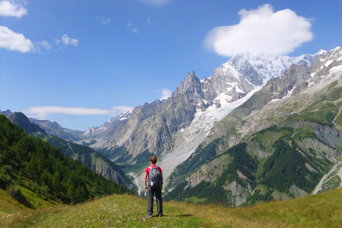
Enjoy magnificent alpine vistas as you circumnavigate Europe’s highest mountain
Stay in warm, comfortable family-run mountain huts and small hotels
Feast on rich and tasty mountain cuisine, with local specialities from each country
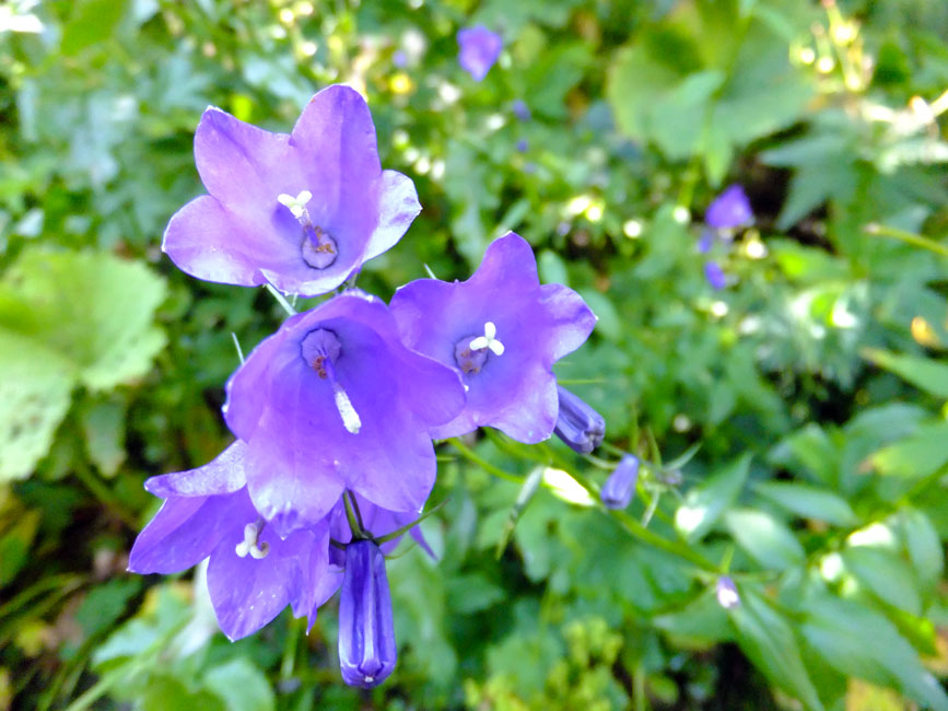
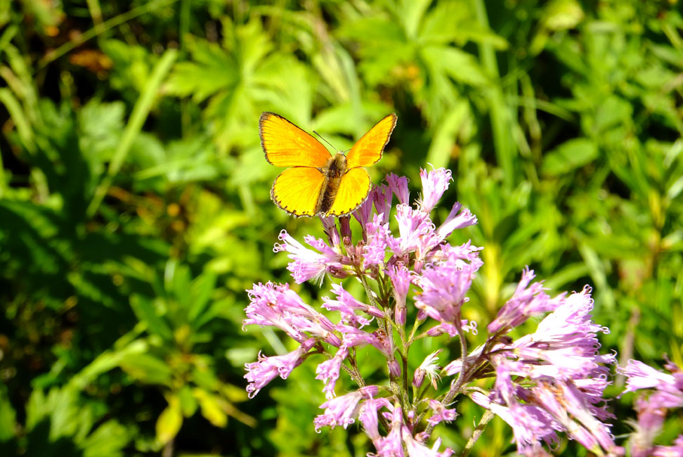
Keep an eye out for mountain wildlife, including marmot and chamois
Hiking the Tour du Mont Blanc
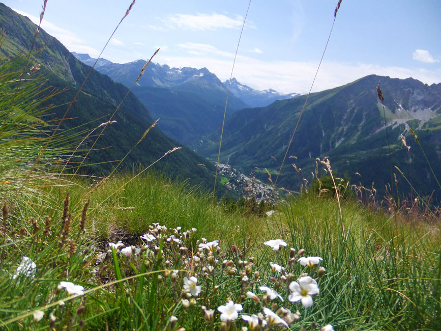
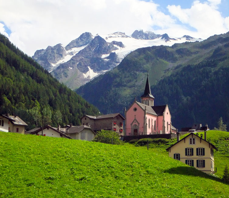
Europe’s most popular long-distance hike is an exhilarating journey through magnificent Alpine landscapes of snow-capped peaks, lush pastures and idyllic meadows. Starting and ending in Chamonix, this 11-day walking holiday takes you in an anti-clockwise direction around the mighty Mont Blanc. Europe’s highest peak (4,810m) is an imposing presence throughout the hike. its peak and upper slopes are snow covered year-round, while picture-perfect glacial valleys fan out from the massif into three different countries. These are carpeted with an incredible variety of alpine flowers in spring and summer.
The Tour du Mont Blanc follows well-marked hiking trails. Daily walks sometimes involve steep ascents and descents but can be walked by a reasonably fit adult. Some stages are very long so we recommend starting early and always make sure you have enough food and water with you. There are no technically difficult sections or any sections requiring scrambling, however some sections are quite exposed and not suitable for anyone suffering from vertigo.
NOTE: Accommodation around Mont Blanc fills up very quickly. Therefore it is advisable to book well in advance to avoid disappointment!
| 11 DAYS / 10 NIGHTS | From €1,099 per person sharing*
*Based on Monday or Tuesday departure staying in dormitory accommodation |
||||||||||||||
| LUGGAGE TRANSPORTATION | Luggage transportation is available between accommodations for a supplement of €270. 1 non-rigid bag of 15kg max per person. | ||||||||||||||
| ACCOMMODATION | Overnight accommodation ranges from simple guest houses to mountain huts to family-run hotels, all surrounded by the beautiful peaks of the Mont Blanc massif.
Several of the accommodations are mountain huts, with shared bathrooms, in some of them only dormitory is available. Some accommodation have double rooms with or without en-suite bathroom. Please note that you will need to bring a sheet/sleeping bag liner for the nights in the mountain huts. Upgraded accommodation is available in hotels with private double rooms for a supplement*. *Apart from day 9, as there is no hotel accommodation available in Argentière. |
||||||||||||||
| AVAILABILITY | You can start on any day of the week, subject to availability, between June 17th and September 19th. We strongly advise to start on Tuesday, Wednesday Thursday or Friday, as there is a better chance of availability.
Accommodation on this trip fills up very quickly, so we recommend booking well in advance. |
||||||||||||||
| INCLUDED |
|
||||||||||||||
| NOT INCLUDED |
|
||||||||||||||
| OPTIONAL EXTRAS |
|
||||||||||||||
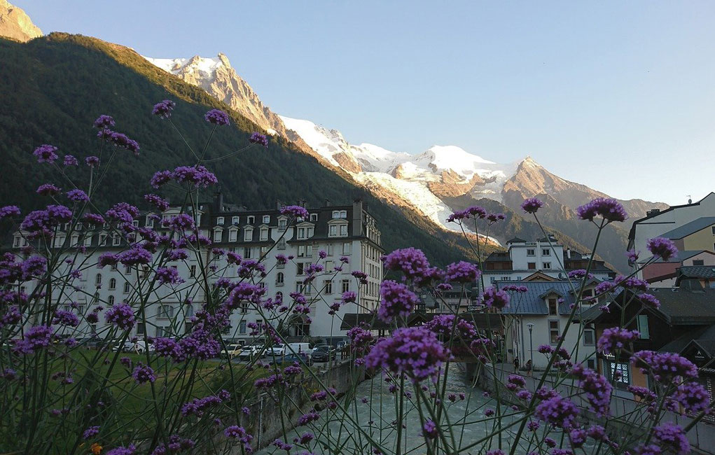
The trek starts in Chamonix: on your first day you can spend your day wandering through the streets of this lively adventure sports hub, do a little last-minute shopping in the many outdoor shops or maybe spoil yourself with a visit to the spa.
Distance: 20 km | Ascent: 987 m | Descent: 1094 m | 7 hrs approx.
Today’s walk starts with a bus from Chamonix to Les Houches, from where you take the Bellevue cable car up to 1800m. From here, instead of going up the “French normal route” of Mont Blanc (up to the Gouter hut at 3800m and to the summit at 4810m) you follow the edge of the mountain to Col de Voza and then start descending to the valley. Here you can observe the traditional local way of making roofs for mountain houses, with large flat stones. Later you pass through several small villages on the valley floor, with glimpses of Mont Blanc high above. The last part of the trail is along the Bon Nant river to Les Contamines.
You then continue along an ancient Roman path and one of Europe’s most famous trails, across blooming meadows and striking woodland to the refuge; a typical mountain chalet with a breathtaking view. Walkers are accommodated in small dormitories for between six to nine people and a hearty evening meal is served in the chalet’s cosy dining room.
Overnight: Les Contamines
Distance: 15 km | Ascent: 900 m | Descent: 900 m | 7 hrs approx.
Today’s walk takes you through the Plan des Dames up to the Col du Bonhomme (2329m), then climbing a little further to the Col de la Croix du Bonhomme (2479m). You’ll see a peculiar combination of stones marking the top of the pass, from where you can admire the Alpine valleys stretching out for miles around you. From the pass you make a long descent through the open meadows of the Vallee des Chapieux, criss-crossing small brooks and passing mountain huts. At the bottom of the descent you reach the tiny village of Les Chapieux. Your accommodation tonight is a simple and cosy mountain auberge.
Overnight: Les Chapieux
Val Veny: Distance: 14 km | Ascent: 1250 m | Descent: 1180 m | 5 hrs approx.
Cormayeur: Distance: 19 km | Ascent: 1500 m | Descent: 1380 m | 7 hrs approx.
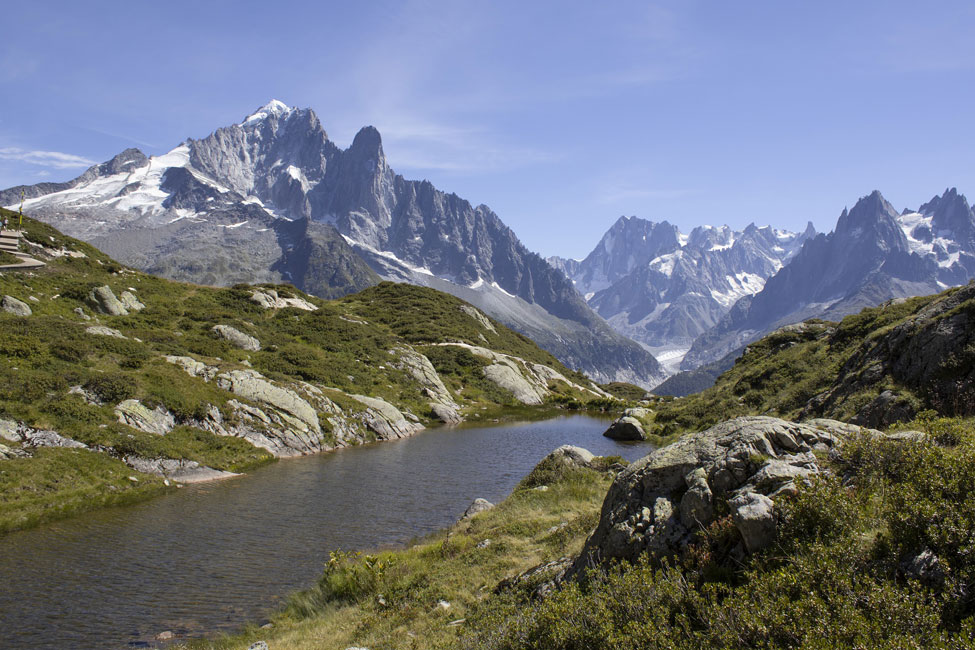
Today is the longest and most demanding day of the holiday but also incredibly scenic, with surprising landscapes all the way. After two days spent walking in France, today you go over the Col de la Seigne (2516m) and through the Val Veny into Italy. The day starts off with a climb through a deep gorge surrounded by vast pastures with lunar-like scenery as a backdrop. The Col de la Seigne and the Aiguille des Glaciers mountains loom large in the distance on the border between Switzerland and Italy. Once over the top of the pass you descend into the Val Veny Valley on the opposite side to Mont Blanc, from where you can enjoy magnificent views of the snow-capped peaks of the Mont Blanc massif.
Depending on avaibility, today you may be booked at a nice Rifugio in Val Veny or in Courmayeur: if you are booked in Cormayeur, you will walk 5.5 kilometres to reach a bus stop in La Visaille where you will take a bus to Courmayeur.
Overnight: Val Veny/Cormayeur
Val Veny: Distance: 12 km | Ascent: 900 m | Descent: 800 m | 4½ hrs approx.
Cormayeur: Distance: 5.5 km | Ascent: 300 m | Descent: 400 m | 2½ hrs approx.
Today’s walk is divided into 2 parts; if you have slept in Rifugio Elisabetta, in the morning you will walk 5.5 km to the bus stop and descend towards the famous town of Courmayeur by bus. Courmayeur is a renowned ski resort where you can have a well-deserved rest before starting off again with a steep ascent followed by a level walk through meadows and conifer woods to Val Ferret, passing many small brooks, with the wonderful, awe-inspiring silhouette of the Grand Jorasses standing out. If you feel tired, or if you prefer to stroll through the streets of the centre, you can stop in Courmayeur and then take a bus directly to Val Ferret.
Overnight: Val Ferret
Distance: 18 km | Ascent: 870 m | Descent: 920 m | 6 hrs approx.
This morning’s walk will take you up a steep ascent and past ruined farmhouses. This marks the start of your journey into Switzerland. The first 4 or so kilometres are a gradual 150m ascent along a surfaced road. If you wish, you can avoid this section by taking the SAVDA bus that stops in front of the hotel. From Waypoint 4 a steep and rewarding climb takes you to Rifugio Elena then on to the border crossing with Switzerland, at the top of the Col du Gran Ferret (2537m). The views of the receding Glacier and the perennial snow of Triolet and Pre de Bar are magnificent. The descent is through vast open meadows with very few traces of human settlement. You pass a couple of mountain huts then nearing the small hamlet of Ferret and on to La Fouly. The trail passes through idyllic scenery of forests, creeks and picturesque wooden bridges. You spend the night in the village of La Fouly.
Overnight: La Fouly
Distance: 18 km | Ascent: 700 m | Descent: 715 m | 6 hrs approx.
After the efforts of the last few days, today offers you an easier walk. This section is quite long, but the elevation gains and losses are not so pronounced. Starting off from La Fouly, you follow the river encountering a succession of woods, interrupted by cliff walls and small streams. You then walk through meadows to reach Les Arlaches, a beautiful hamlet with many traditional wood and stone houses. The last stretch is up a long winding climb, it’s not too steep and there are interesting wooden sculptures along the way. At Orsieres the trail descends to Champex-Lac, a pretty mountain village situated on the lake.
Overnight: Champex-Lac
Distance: 16 km | Ascent: 711 m | Descent: 1125 m | 7 hrs approx.
A spectacular walk over the Fenêtre d’Arpette (2665m) from where you descend along the Glacier du Trient. Trient (1300m) is a village on the pass road from Martigny to Chamonix.
In bad weather, there is an alternative route, From Arpette to Trient via Champex-d’en Haut, through cool forests and beautiful alpine meadows that take you to Col de la Forclaz, which is an important link between Switzerland and France. This walk enjoys breath-taking panoramas and reaches 2050m.
Overnight: Trient
Distance: 15 km | Ascent: 985 m | Descent: 906 m | 4 hrs approx.
Starting above the ski resort of Le Tour, you first hike towards Lake Charamillon (2271 metres). You then continue onward to the immense Glacier du Tour and back into France. An exhilarating rocky trail along the mountain crest allows you to enjoy astounding views of the glacier and the surrounding valleys. As you reach the border between Switzerland and France, you can see Mont Blanc shining white, especially on sunny and bright days. You descend among pastures for the last section of the walk until you arrive at Argentière.
Overnight: Argentière
Distance: 19.5 km | Ascent: 1623 m | Descent: 971 m | 8 hrs approx.
OR
Distance: 17.5 km | Ascent: 1443 m | Descent: 789 m | 7 hrs approx.
Your final walk is quite long so make sure to start early! You begin walking through the pretty little village Les Frasserands, with the typical wooden houses of the French alps. You then follow a botanic path before climbing uphill, into the Aiguilles Rouges Natural Park. You can decide if you want to continue to climb up to Lac Blanc (it involves climbing an iron ladder, so not for vertigo sufferers) or start descending to La Flegere. The route is very panoramic; in front of you the Mont Blanc massif, with the Aiguille Verte, the Drus, the Aiguille du Midi, Mont Blanc du Tacul and Mont Blanc, untill you arrive at Planpraz, where the cable car will take you down to Chamonix (last one is at 5 pm). If you are tired or in short of time you can also take the cable car at La Flegere.
Overnight: Chamonix
The trip and our services end after breakfast unless you have booked extra services or extra nights.
Getting to Chamonix


Tour Reviews
There are no reviews yet.
Leave a Review